 | 1. Lower Town in the mist |
 | 2. Indus River at Mohenjo-daro |
 | 3. Mohenjo-daro "Citadel" mound and Stupa in the mist |
 | 4. Kids in Mohenjo-daro |
 | 5. Sunrise over Mohenjo-daro |
 | 6. Mohenjo-daro "Citadel" Mound and Stupa |
 | 7. The Indus River and "lower town" |
 | 8. Farmlands to the west of Mohenjo-daro |
 | 9. Northeastern sector of Mohenjo-daro: DK-G area north |
 | 10. Northeastern sector of Mohenjo-daro: DK-G area south |
 | 11. Mohenjo Daro Lower Town: VS Area |
 | 12. Mohenjo Daro Lower Town: HR Area |
 | 13. Mohenjo Daro Lower Town: VS Area |
 | 14. Mohenjo-daro Lower Town: HR area and Stupa |
 | 15. Mohenjo-daro Lower Town: VS area and Stupa View |
 | 16. Mohenjo-daro Lower Town: Main Street HR/VS area and stupa view |
 | 17. Conservation of brick walls in DK - G Area, Lower Town |
 | 18. Eroded surface of the mound DK-I Area |
 | 19. Room in between L and SD Areas |
 | 20. Lower Town: HR Area mud brick platforms |
 | 21. Nodule and Pottery Foundation fill, HR Area |
 | 22. Excavation Debris Pile, DK-I Area |
 | 23. Great Bath and Granary, SD Area |
 | 24. Great Bath and Granary, SD Area, looking west from the stupa mound |
 | 25. Great Bath, SD Area, looking north |
 | 26. Lower ledge inside the Great Bath, SD Area, southern edge, looking east |
 | 27. Great Bath, SD Area, looking north |
 | 28. Great Bath, SD Area, looking north |
 | 29. Lower ledge and Drain outlet, Great Bath, SD Area, looking west |
 | 30. Great Bath, SD Area |
 | 31. Corbelled Drain exiting the Great Bath |
 | 32. Looking out from inside the drain |
 | 33. L Area as seen from the Stupa Mound |
 | 34. L Area |
 | 35. Pillared Hall, L Area |
 | 36. Pillared Hall, L Area |
 | 37. Lower Street 3, HR Area |
 | 38. College Building Courtyard, SD Area |
 | 39. Gateway (ACC Area) with Stupa in background |
 | 40. Granary, SD and REM area |
 | 41. Eroded face of Granary |
 | 42. View of well to the east of the Granary |
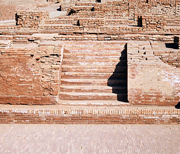
 | 43. Western Staircase, House I, HR area |
 | 44. House I, HR area |
 | 45. Well surrounded by paving, DK-B area |
 | 46. Well surrounded by paving, DK-B area |
 | 47. Toilet, HR area |
 | 48. Toilets, HR area |
 | 49. HR area, corbelled arch drain |
 | 50. HR area, Dead man's lane and First Street |
 | 51. HR area, large courtyard (room 70) |
 | 52. HR area, large courtyard (room 70) with blocked drain in the background |
 | 53. Dyer's Workshop, VS Area |
 | 54. Room of the Skeletons, HR Area |
 | 55. Blocked Corbelled Drain, HR Area |
 | 56. Wells and walls, DK-G Area |
 | 57. Looking down inside two rooms, DK-G area, near chief's house |
 | 58. Remodeled walls, DK-G area |
 | 59. Large Courtyard with mud brick filling, DK-G Area |
 | 60. Conservation and Remodeling, DK-G Area |
 | 61. Chief's House, DK-G Area |
 | 62. Chief's House, DK-G Area |
 | 63. Narrow Lane, DK-G Area |
 | 64. Blocked Street to the east of First Street, DK-G Area |
 | 65. First Street, DK-G Area |
 | 66. Narrow Streets and Drains, DK-G |
 | 67. Stairs leading to the second storey, DK-G Area |
 | 68. Narrow Streets, DK-G Area |
 | 69. Narrow Streets, DK-G Area |
 | 70. Traffic Control Block and Street, SD Area |
 | 71. Street with Limestone covered Drain SD Area |
 | 72. Limestone drain covers, SD Area |
 | 73. Covered Drain, SD Area |
 | 74. Covered drain, Divinity Ave, SD Area |
 | 75. Small well and platform, VS Area |
 | 76. Large Well, HR Area |
 | 77. Oval Well, SD Area |
 | 78. Public well, HR Area |
 | 79. Well and platform, DK-G Area |
 | 80. Private Well, DK-G |

No comments:
Post a Comment