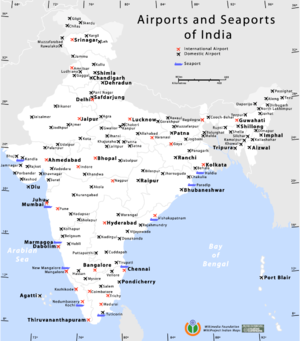
Map showing the location of airports and seaports in India
This includes a
list of airports in India. The list includes commercially used, former, flying schools, military bases. This list contains the following information:
- City served – The city generally associated with the airport. This is not always the actual location since some airports are located in smaller towns outside of the city they serve.
- ICAO – The location indicator assigned by the International Civil Aviation Organization (ICAO). ICAO indicator: VA – West Zone, VE – East Zone, VI – North Zone, VO – South Zone
- IATA – The airport code assigned by the International Air Transport Association (IATA).
- Category – Category of the airport as defined by Airports Authority of India[1] as per the table below
- Role – Role of the airport as given by the table below
Category of Airport
| Category | Description |
|---|
| Customs | Airports with customs checking and clearance facilities handling international flights but not elevated to International Airport status. |
| Domestic | Handles domestic flights |
| Future | Project proposed or under construction |
| International | Handles international flights |
| Private | Private airport for specific purposes |
Role of Airport
| Role | Description |
|---|
| Civil enclave | Civil Enclaves in a Military Airport. Handles Commercial Flights |
| Closed | No longer in operation for Commercial Flights |
| Commercial | Handles Commercial flights |
| Airbase | Military Airbase |
| Flying School | Airport used to train commercial and/or fighter pilots |
| Commercial service | Airport has commercial service |
| Airport has no commercial service |

1 comment:
When it comes to visit so transportation plays biggest role we are live in Corbett National Park and the nearest Airport is Pantnagar and International Airport is Delhi ( Indera Gandhi Internation Airport).
Post a Comment